Near real-time cloud-corrected UV index
Description
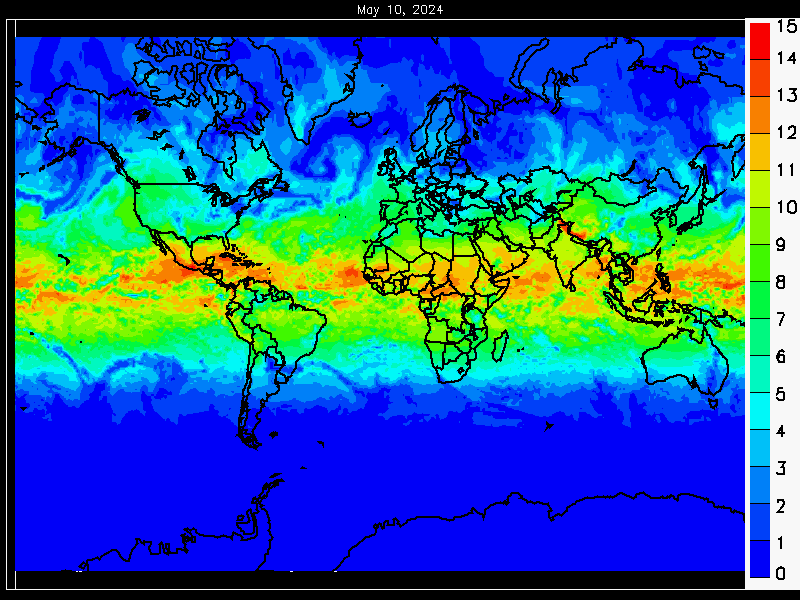
The near real-time cloud-corrected UV index provides one day global forecast of expected UV index at the expected cloud cover conditions at local noon.
Type
Near real-time. The product is ready for dissemination 03:00 UTC at the latest.
Theoretical basis
The cloud-corrected product is the clear-sky product modified with an algorithm using the cloud cover fraction forecast from ECMWF to reflect the actual UV index.
Processing
Assimilated total ozone data is processed at the DMI using NUV software. The data processor reads the ATO data and calculates UV index for each data point in the ATO file. ECMWF cloud cover forecast is spatially interpolated to the ATO grid and in time to local noon at each grid point.
Units and spatial resolution
UV index is a unit of measure of UV levels relevant to the effects on human skin. It is expressed numerically as the equivalent of multiplying the time weighted average effective irradiance (W/m2) by 40. The UV index maps are calculated in the same grid size as the input ATO field, with a sub-pixel altitude correction resolution of 0.25° x 0.25°.
Validation
This product is validated by the DMI. Validation is based on detailed comparison with ground-based measurements.
Online quality monitoring
The product quality is constantly monitored by DMI. On the NUV website various quality plots and files are updated daily.
Dissemination
File format
This product is available as global and continental maps in PNG image format. Users can request the whole or partial dataset in various data formats and/or delivery methods, see NRT access information.
Algorithm version information
| Time period | GOME-2 / Metop-A | GOME-2 / Metop-B | GOME-2 / Metop-C |
|---|---|---|---|
| 03.09.2012 - 13.07.2013 | 3.2 | N.A. | N.A. |
| 14.07.2014 - 15.07.2020 | N.A. | 3.3 | N.A. |
| 16.07.2020 onwards | N.A. | 3.3 | 3.3 |
Documents
- Product user manual
- Algorithm theoretical basis document
- Validation report
- Validation report (supplement for Metop-B)
The most recent near real-time cloud-corrected UV index from the Metop-C satellite